
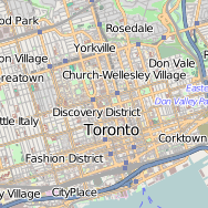
 The OpenStreetMap project has over half a million map contributors and a fairly extensive developer community. This past weekend, the first-ever OpenStreetMap hack weekend was held in Toronto, Canada (second-ever North American hack) at Ryerson University. This event was jointly hosted with the Department of Geography, Master of Spatial Analysis and the Student Association of Geographic Analysis. Event coördination was taken care of by Richard Weait, long-time advocate of OpenStreetMap.
Mar 212012
Aug 222011
![]() Lets talk about QGIS for a little bit before we go ahead and install it on our systems. QGIS is an open source GIS package that is under the GNU public license. It offers enough functionality for someone with a ArcInfo Student License (myself) to want to explore. The usage of QGIS in day to day tasks has me spending less time Continue reading »
Lets talk about QGIS for a little bit before we go ahead and install it on our systems. QGIS is an open source GIS package that is under the GNU public license. It offers enough functionality for someone with a ArcInfo Student License (myself) to want to explore. The usage of QGIS in day to day tasks has me spending less time Continue reading »
Aug 212011
![]() I can think back and remember struggling with being able to utilize OpenStreetMap (OSM) data in a project of mine. I wanted a free source of information and geospatial data, where I was not bound to strict and limiting copyrights. OpenStreetMap offered a one-stop-shop for free and open geospatial data. At the time, I was most interested in utilizing their very detailed road network. However, I ran into many hiccups along the way, which ultimately deterred me from completing the project. Some time has passed and I have returned to said Continue reading »
I can think back and remember struggling with being able to utilize OpenStreetMap (OSM) data in a project of mine. I wanted a free source of information and geospatial data, where I was not bound to strict and limiting copyrights. OpenStreetMap offered a one-stop-shop for free and open geospatial data. At the time, I was most interested in utilizing their very detailed road network. However, I ran into many hiccups along the way, which ultimately deterred me from completing the project. Some time has passed and I have returned to said Continue reading »