
Portfolio
I am pleased to present the following collection of works that undoubtedly show my confidence of skills in the fields of GIS analysis and web-mapping. Here you will find a series of authored works that have been completed as part of a variety of professional contracts, academic work experience and personal interest projects. If you seek more detail, please feel free to contact me with regards to any of the projects listed below.
Mapping-Out Windfarm Viewsheds

Map 1

Map 2
Purpose: The work attempts to provide greater information about the cumulative effects of wind turbines in the Scottish landscape, such as how many turbines are visible, how much of them can be seen given the terrain and exactly big they look.
Details: The Scottish landscape is plagued by sprouting windfarm developments, which promises to increase due to recent targets of 100% sustainability by 2020, set by the Scottish National Party. In an attempt to provide greater understanding of how the windfarms affect the Scottish natural landscape, we utilize various spatial GIS tools to identify the extent of visibility of windfarms in the countryside. By identifying the extent of visibility (Map 1) of all windfarms in Scotland, we are then able to reverse engineer the viewshed to identify the lowest impact zones (Map 2) for further development.
Scope: This work is part of ongoing research that aims to guide policy and decision making with regards to windfarm development in Scotland. Feel free to contact me if you would like more detailed project information.
Analysis and Cartography by Steve Carver and Michael Markieta of the Wildland Research Institute. © Wildland Research Institute, 2011.
Census-Driven Maps
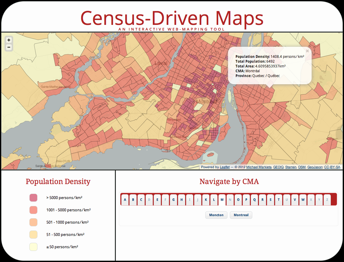
Purpose: This web mapping application was created by Michael Markieta and presented to Ryerson University in partial fulfillment for the requirements of Professional Geographer (GEO871), a capstone course of the Geographic Analysis program. It is an interactive web-based mapping tool that provides users with access to a geovisual representation of the Canadian 2011 Census of the Population.
Details: This research project utilizes the Leaflet JavaScript library to produce an interactive web-mapping tool, which aims to visualize the recently released Statistics Canada 2011 Census of the Population. The data is hosted in an open-source cloud-based geospatial database, CartoDB, which serves our data storage and retrieval needs. CartoDB is based on the PostgreSQL database and spatial extension PostGIS, which utilizes SQL and a variety of other tools. The jQuery JavaScript library provides the interactivity between the user and map environments.
©2012 Michael Markieta http://www.spatialanalysis.ca/projects/census-app.html
A Locally Weighted Human Influence Index
Map Overlay and Opacity Tool v2.0