
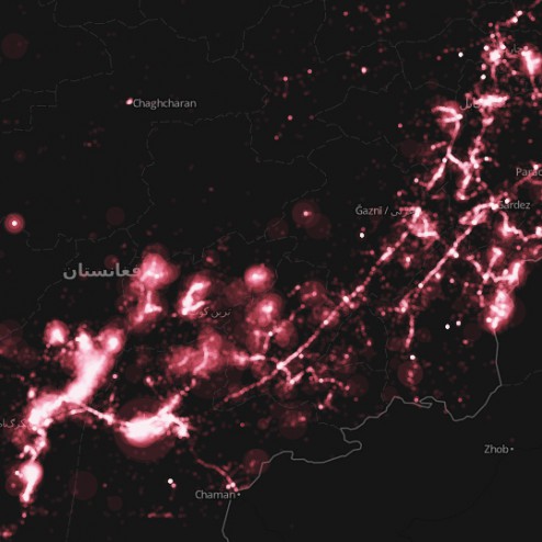
 The Afghan War Diary, made available by the Wikileaks group, is the disclosure of internal US Military logs. Wikileaks has been known to release data that contains latitudinal and longitudinal information useful for spatial analysis. I’ve taken the liberty to map the some-76,000 military logs.
The military logs are a collection of top secret classified correspondences that detail various military encounters and situational reports. Some of the most popular headings in the log are: enemies killed/wounded in action, friendlies killed/wounded in action and reporting unit (squad/other).

 My intentions for this blog are to spur intelligent and thought provoking discussions and to provide some insight and/or help to those who may want to delve into various spatial analyses and cartographic trends/methodologies. Cartograms are definitely one of the most trending topics in discussions on how to alternatively geovisualize spatial phenomena. The idea roots back more than half a decade and has evolved from a ‘pencil and graph paper’ skill to a geographical information system (